The National Hurricane Center said Sunday evening that it is tracking Tropical Cyclone Seven. The weather system was 175 miles east-southeast of Marathon and had maximum sustained winds of 30 mph at about 11 p.m. ET on Sunday.
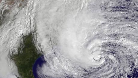
It was moving west-northwest at 15 mph and is forecast to pass over the Florida Keys Monday afternoon, emerge over the southeastern Gulf of Mexico by Monday evening and reach the central Gulf Coast by late Tuesday night.
The system is likely to strengthen into a tropical depression Monday morning, then a tropical storm with the name Gordon by Monday evening, CNN Meteorologist Gene Norman said.
A tropical storm watch has been issued for portions of the central Gulf Coast from the Alabama-Florida border westward to east of Morgan City, Louisiana, including Lake Pontchartrain.
A Storm Surge Watch is in effect from the Mississippi-Alabama border westward to the mouth of the Mississippi River.
"Potential Tropical Cyclone Seven will bring heavy rainfall and gusty winds to portions of the Bahamas, South Florida, and the Florida Keys tonight and Monday, and interests in those areas should monitor the progress of this system," the National Hurricane Center said Sunday.
It warned that heavy rainfall from the system would affect portions of the central Gulf Coast later in the week.
'Get prepared'
Florida Governor Rick Scott tweeted that Floridians and visitors should monitor the weather system and remain vigilant.
"Right now, according to @NHC_Atlantic, the biggest impact to our state will be heavy rain, but in Florida, we know how quickly weather can change," he said.
"With the peak of hurricane season upon us, now is the time to get prepared. Make sure that you and your family have a plan in place in case of disaster."
Bagikan Berita Ini


0 Response to "Tropical storm watch issued for parts of the Gulf Coast"
Post a Comment